Hard Copy Maps
The catalogue contains information about the maps, gazetteer, aerial photographs, photo-mosaics and other digital and hard copy products and services available at the Guyana Lands and Surveys Commission (GLSC), Land Information and Mapping Division (LIM).
Free & Digital Maps
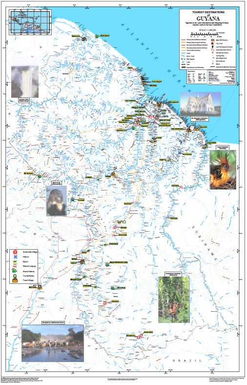
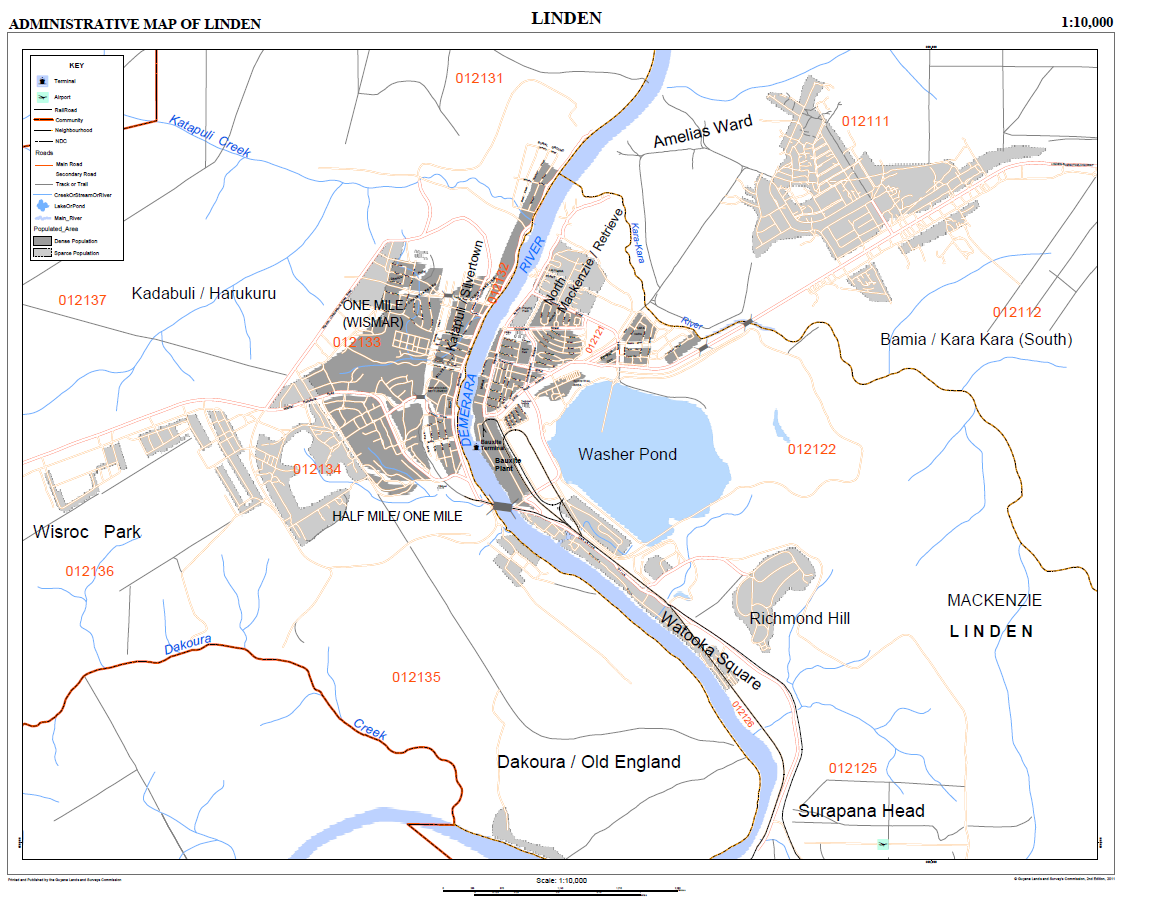
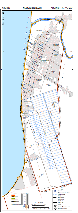
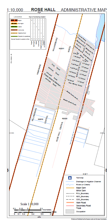
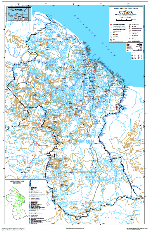
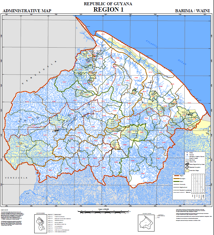
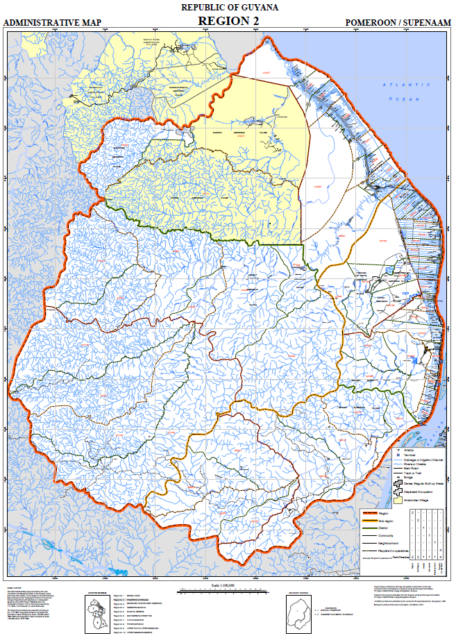
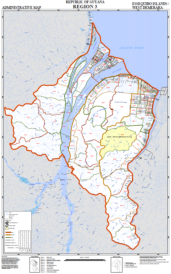
The attached catalogue contains information about the maps, gazetteer, aerial photographs, photo-mosaics and other digital and hard copy products and services available at the Guyana Lands and Surveys Commission (GLSC), Land Information and Mapping Division (LIM). Detailed descriptions are given of the type of map products and services available. Additionally, extracts from most of our maps are included as samples of our production line. Being the leading provider in Guyana of high quality large and small-scale spatial data to Government as well as other map users, we ensure that our data is of a high standard but that it could also be customized to meet our clients specific needs. Most of our maps are based on conventional mapping. However, within recent years, various GIS software are being used extensively within the GLSC for the digital production of maps. As a pioneer in digital mapping in Guyana, we offer a wide rage of digital services making use of an extensive array of digital software
The following information must be included with the application:
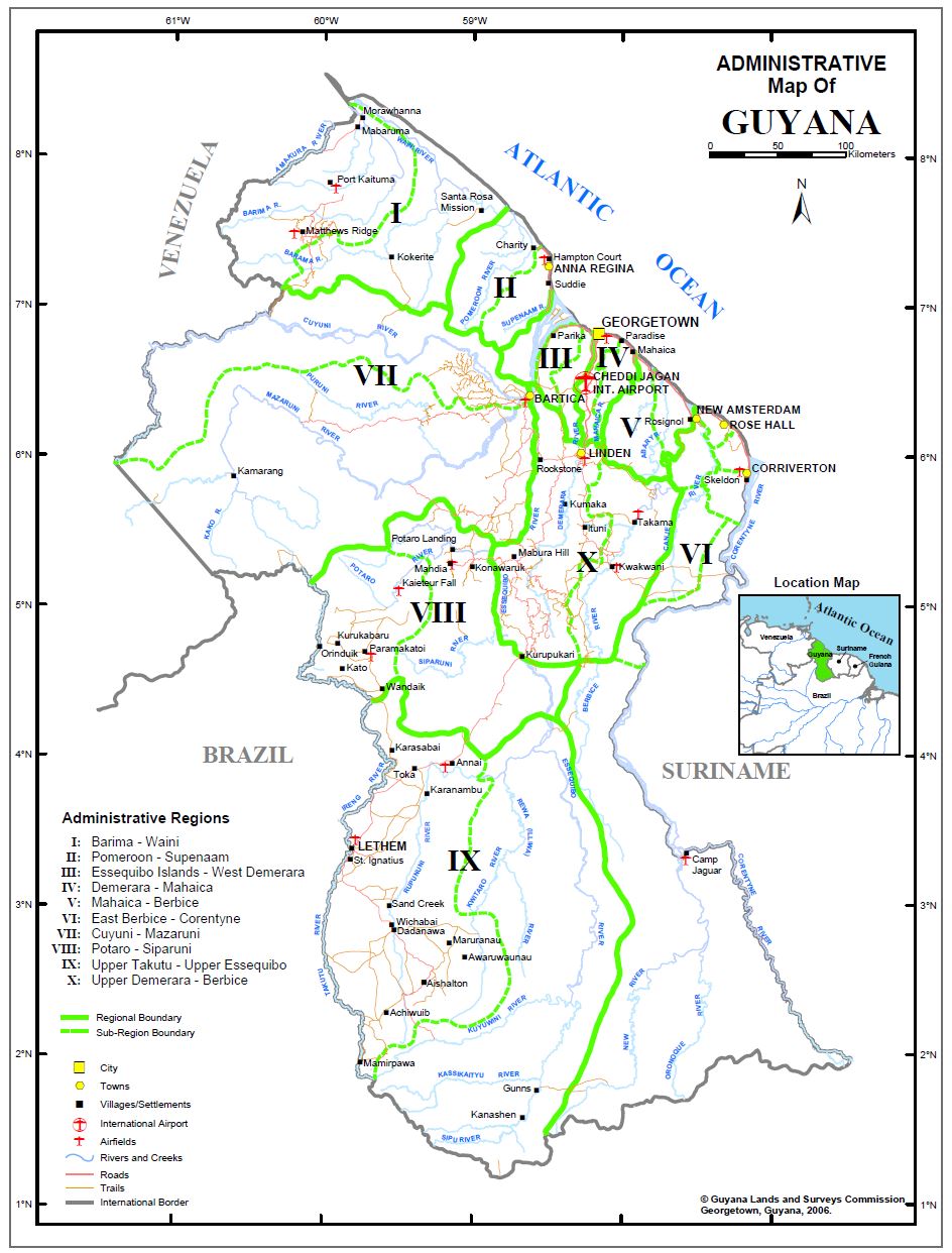
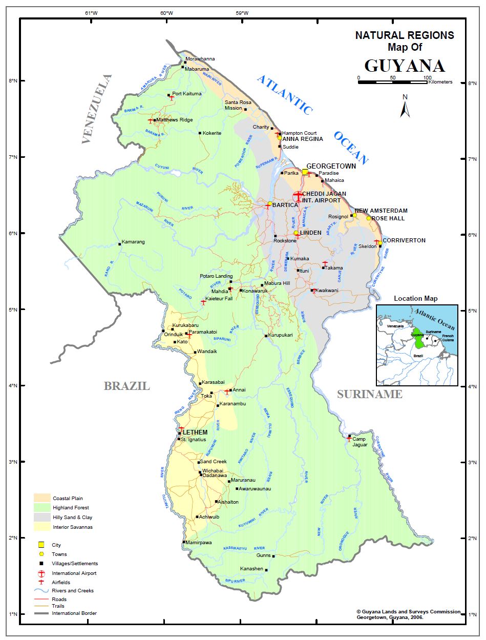
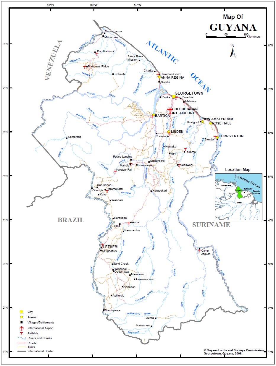
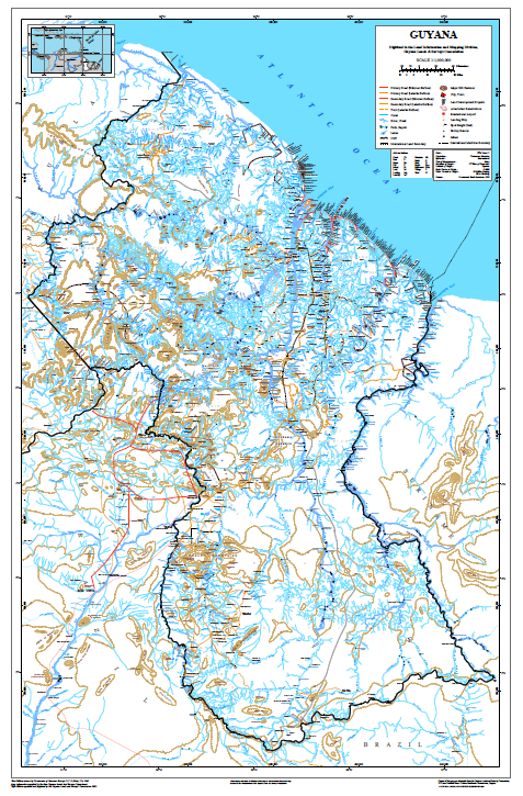
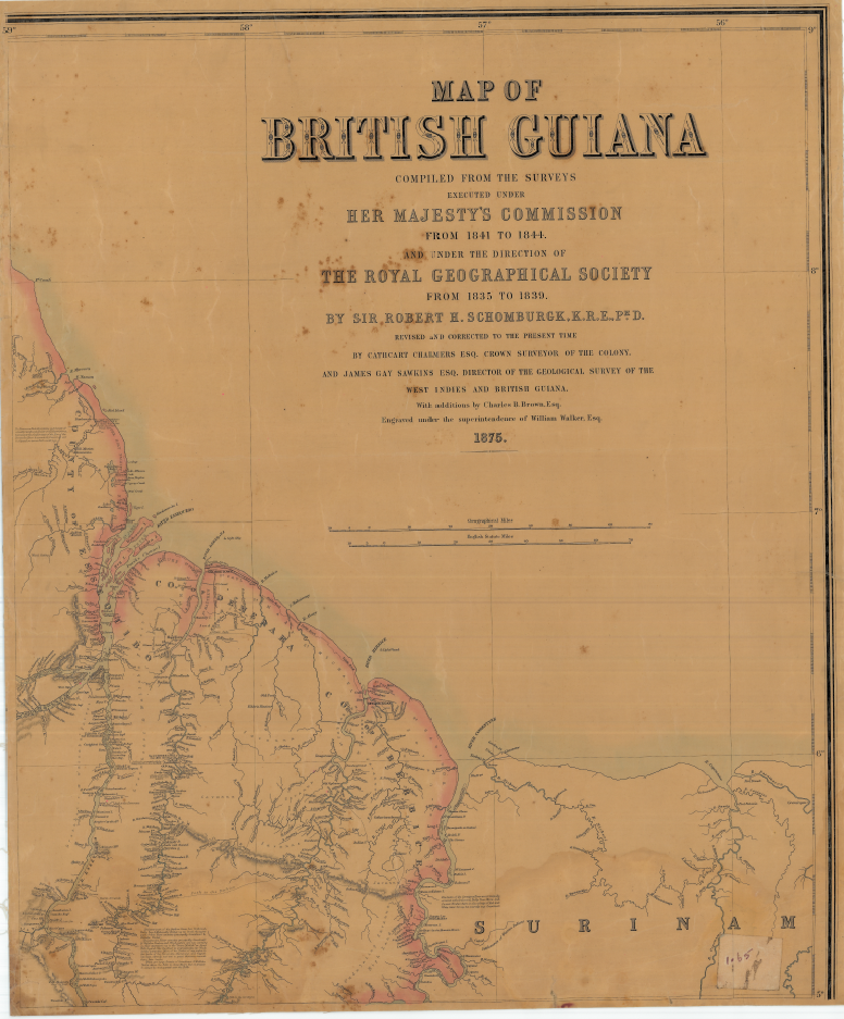
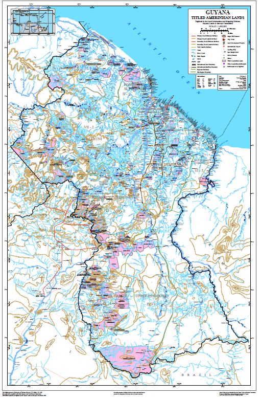
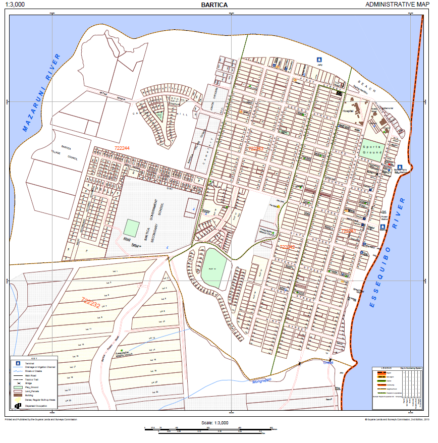
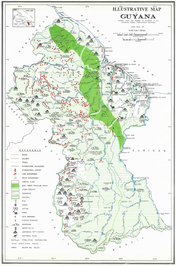
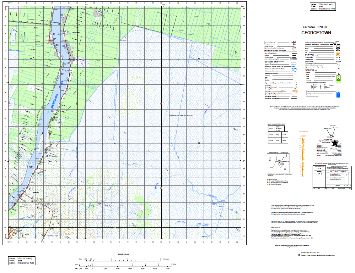
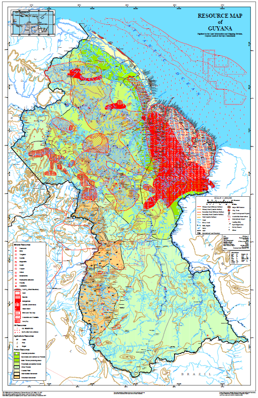
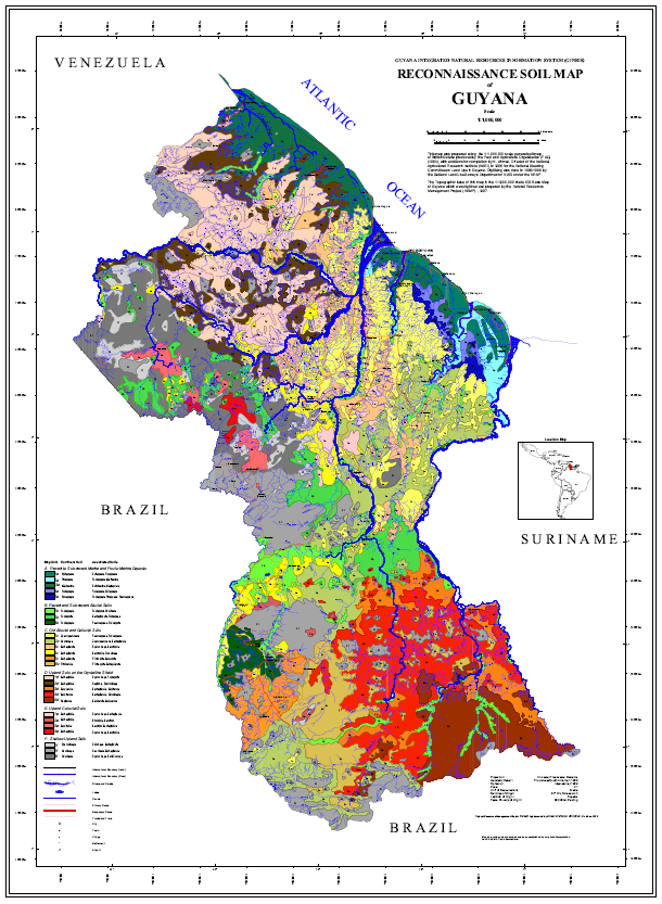
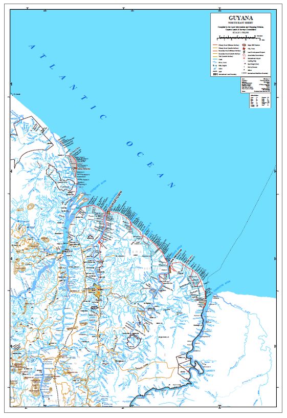
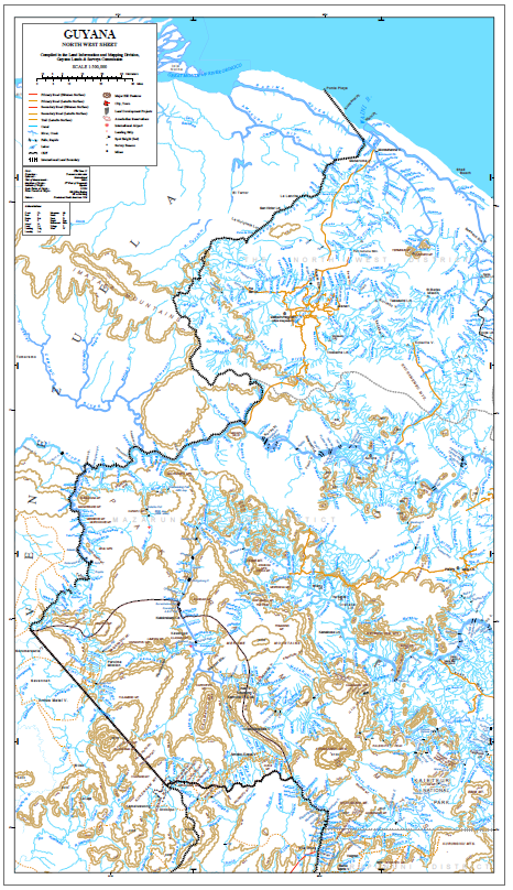
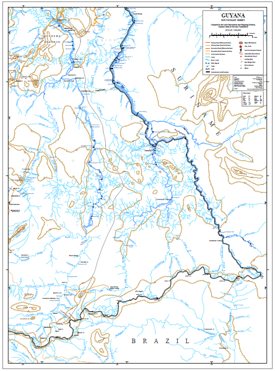
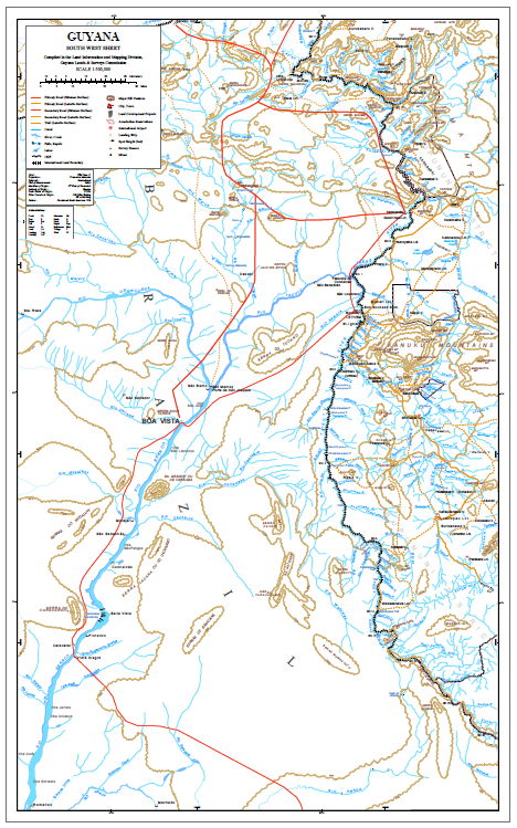
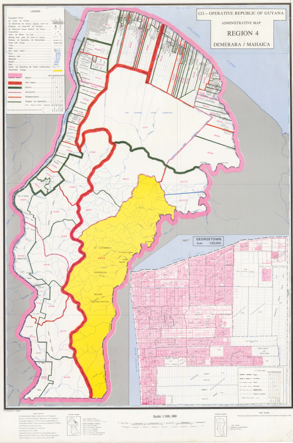
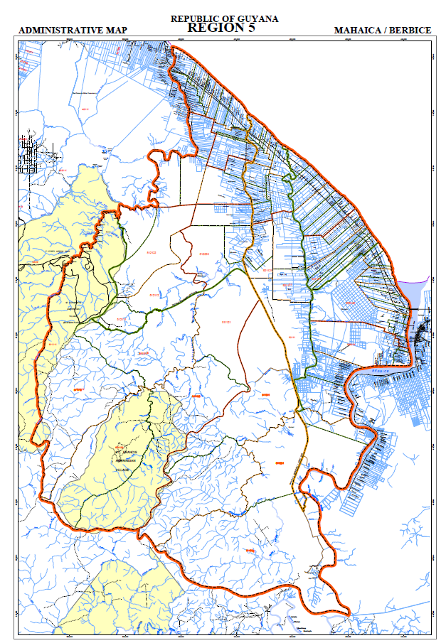
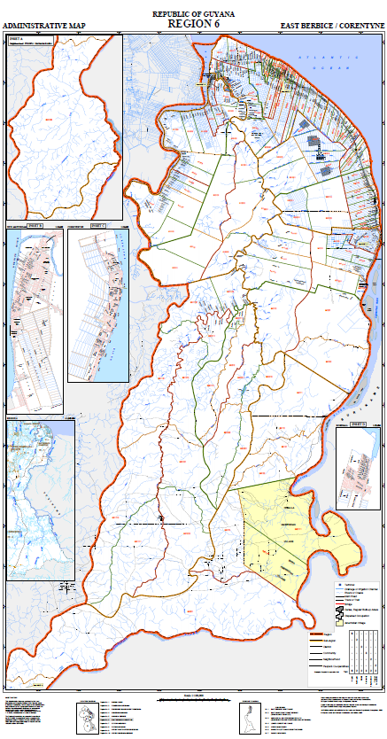
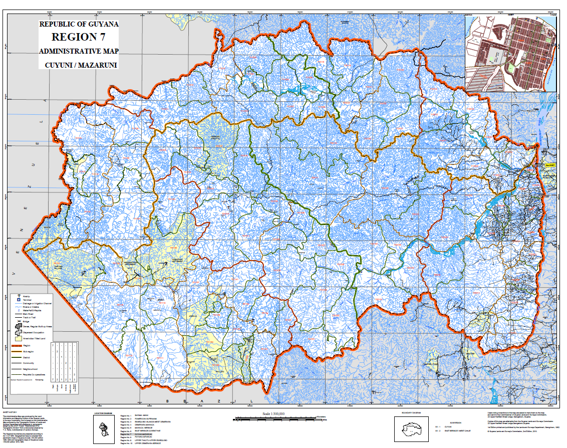
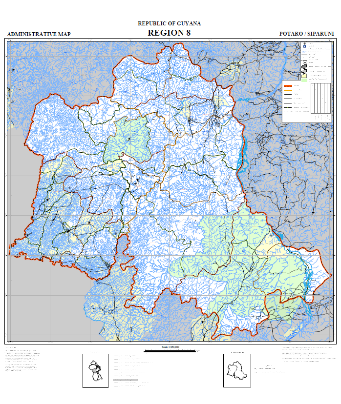
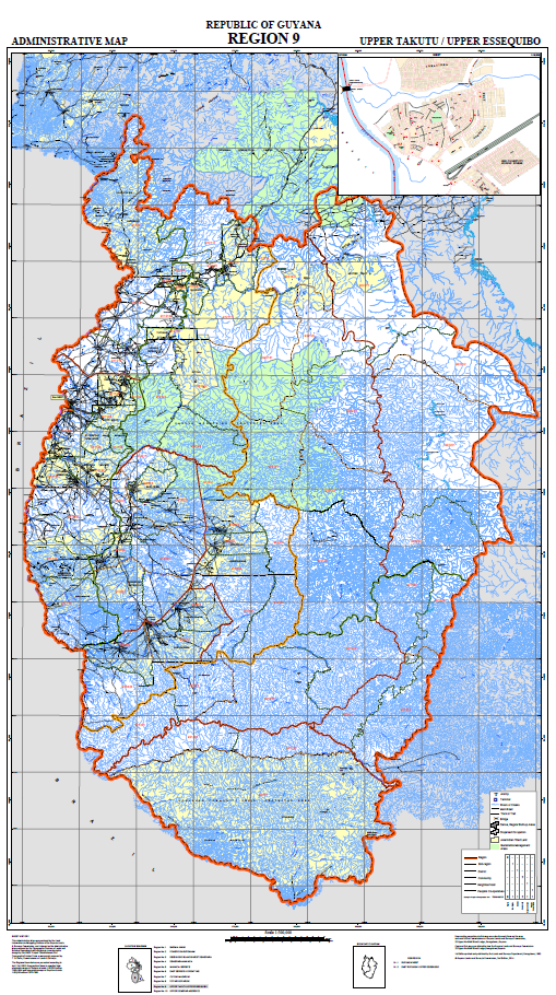
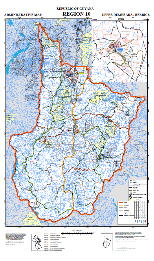
View a few of our maps from our Extensive collection. To View. Click Below
Transferors are required to and must provide the following for processing of an application to transfer:
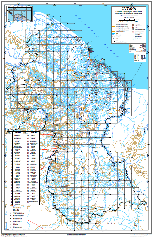
GLSC Map Catalog
National Gazetteer
The National Gazetteer contains six thousand, six hundred and twenty-five (6,625) entries of the names of places and geographical features in Guyana. It is a new compilation and it supersedes the Gazetteer of Guyana published by the Lands and Surveys Department, Ministry of Agriculture, in 1974. The names listed in this Gazetteer include major and minor administrative divisions, populated and other named places, various cultural entities and a variety of geographical features. There are seven columns in which are listed, from left to right, the name, features, locations, latitudes, longitudes, regional codes and the 1:50,000 map reference No. The National Gazetteer is available both as a printed book and as a computer application called the Digital Gazetteer. This application needs to be installed on a windows-based PC. Various functionalities are available in this application such as:
- Search by Name
- Search by Coordinates